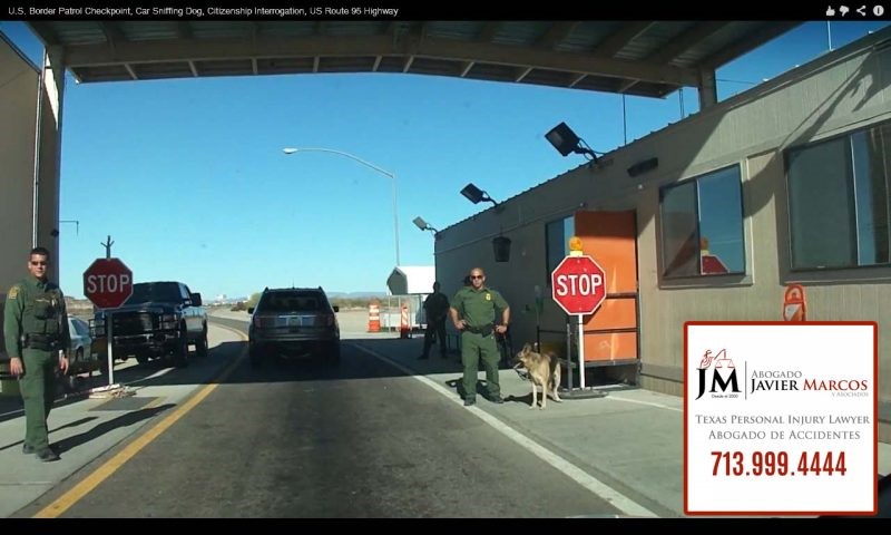
Illegal immigrants that are or already left Corpus Christi and the places that are being affected by hurricane Harvey, have to take precautions with the border patrol. There are several “chekpoints” that are located in the highways near the border. These checkpoints are located about 25 to 72 miles from the border. And their job is to detect any illegal situation that goes through there.
While 2017 hurricane Harvey is taking place, the border patrol have clearly said that they will not close their locations because of the hurricane. They will stay open and going to follow the law of the country. Unless this represents a risk for the agents on these zones.
In other words, people without proper documentation or without papers, have a huge risk with the border patrol. They either have the risk of staying under hurricane Harvey or cross one of these checkpoints and take the risk of being incarcerated or deported for not having papers.
If you have fled or running from a place affected by hurricane Harvey, be precautious. You need to know where these checkpoints are located and if you do not have the proper documentation, do not pass through. Rent a hotel outside the danger zone.
Attorney Javier Marcos | Justice for Hispanics!
Attorney Javier Marcos is an attorney in Texas that can help you on cases of auto accidents, work accidents and construction liens. He has more than 15 years helping people. Do not take a risk in these checkpoints. If you have suffered an auto accident or have any question you can call 24 hours 713.999.4444. The consultation is free, call 24 hours and there is no payment unless we win the case.
Places in Texas with border patrol checkpoints. Wikipedia source.
Texas
I-10 East – between El Paso and Van Horn Tx; Mile Marker 102.
U.S. Route 62 – 33 miles east of El Paso. — 31°49′34.6″N 105°55′04.8″W
Sierra Blanca – located 5 miles west of Sierra Blanca on Interstate 10. — 31°11′29.84″N 105°25′46.83″W
Eagle Pass – located 11 miles east of Eagle Pass on U.S. Route 57. — 28°47′50.45″N 100°22′5.34″W
Eagle Pass/Carrizo Springs – located 30 miles West Southwest of Eagle Pass, Texas on U.S. Route 277. — 28°37′32.6640″N100°03′32.6016″W
Brackettville/Uvalde – located 60 miles east of Del Rio, Texas on Highway 90. — 29°12′57.9024″N 99°56′32.8452″W
Laredo – located 29 miles north of Laredo on Interstate 35. — 27°54′17.85″N 99°23′37.59″W
Laredo 83 – located 35 miles north of Laredo on Highway 83. — 27°59′13″N 99°31′39″W
Freer – located 16 miles west of Freer on U.S. Route 59. — 27°46′26.79″N 98°50′44.09″W
Oilton – located 6 miles east of Oilton on Highway 359. — 27°26′35.72″N 98°53′14.75″W
Falfurias – located 14 miles south of Falfurrias on U.S. Highway 281. — 27°1′29.71″N 98°8′18.39″W
Sarita – located 14 miles south of Sarita on U.S. Route 77. — 27°0′58″N 97°47′39″W
Hebbronville – located 1 mile south of Hebbronville on TX 16 S — 27°16′58.7136″N 98°41′36.3840″W
Hebbronville – located 50 yards south on FM 1017 at “T” intersection of Highway 285. — 27°17′48.3108″N 98°39′46.9872″W
Alpine – located 10 miles south of Alpine on Texas State Highway 118. — 30°11′54″N 103°34′46″W
Brownsville – located on Boca Chica highway leading to Boca Chica Beach — 25°55′24.6″N 97°22′18.8″W
Marfa – located 4.5 miles south of Marfa on U.S. Route 67 — 30°15′06.43″N 104°02′57.88″W


